
Monarch Joint Venture is utilizing drones to enhance how it and other conservation organizations monitor pollinator habitat.
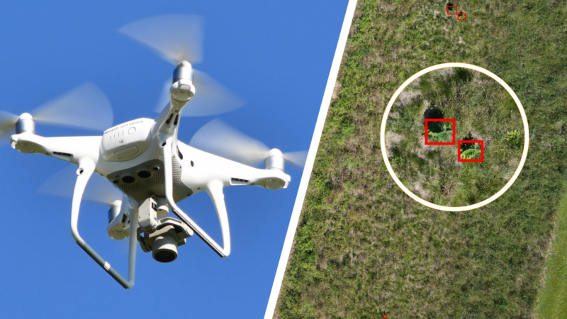
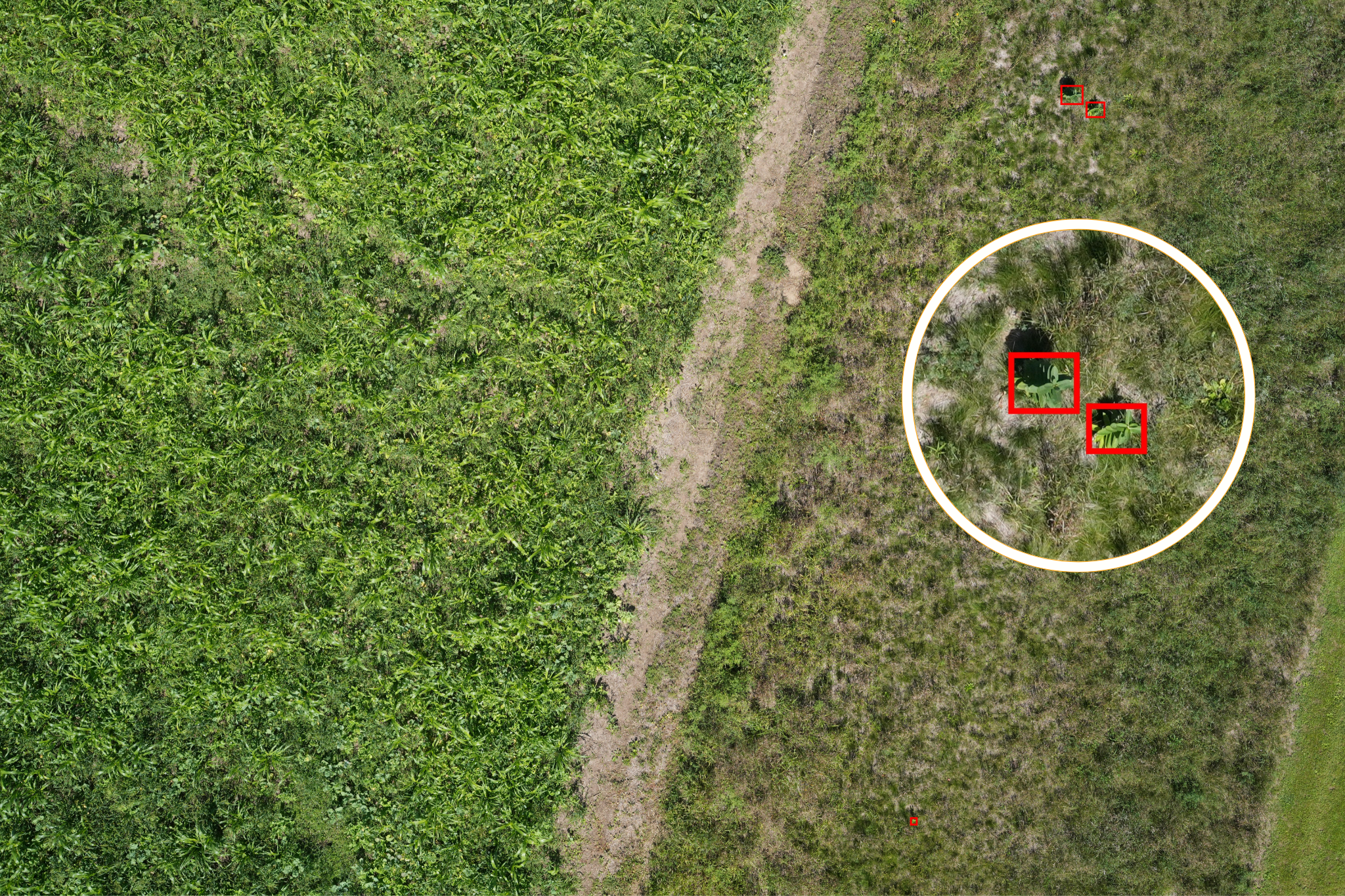
Through the use of remote sensing software, the Monarch Joint Venture and partners are using drones to locate milkweed plants and analyze habitat with greater accuracy and efficiency than ever before. Monarch Joint Venture has worked closely with business partner POLLi as they developed a new software platform to process remotely sensed images.
Common milkweed (Asclepias syriaca), a critical plant for monarchs breeding in the eastern United States, was the pilot model for this expanding platform. POLLi identifies common milkweed stems with impressive accuracy from as high as 120 feet above ground.
The drones follow a preprogrammed route to capture photos that are uploaded to the POLLi platform. POLLi employs machine-learning and cloud computing to quickly and precisely detect common milkweed plants, processing up to 100 images per second. Currently, the program can identify at least 80% of the common milkweed stems in an image with 93% accuracy.
Bringing more organizations onboard
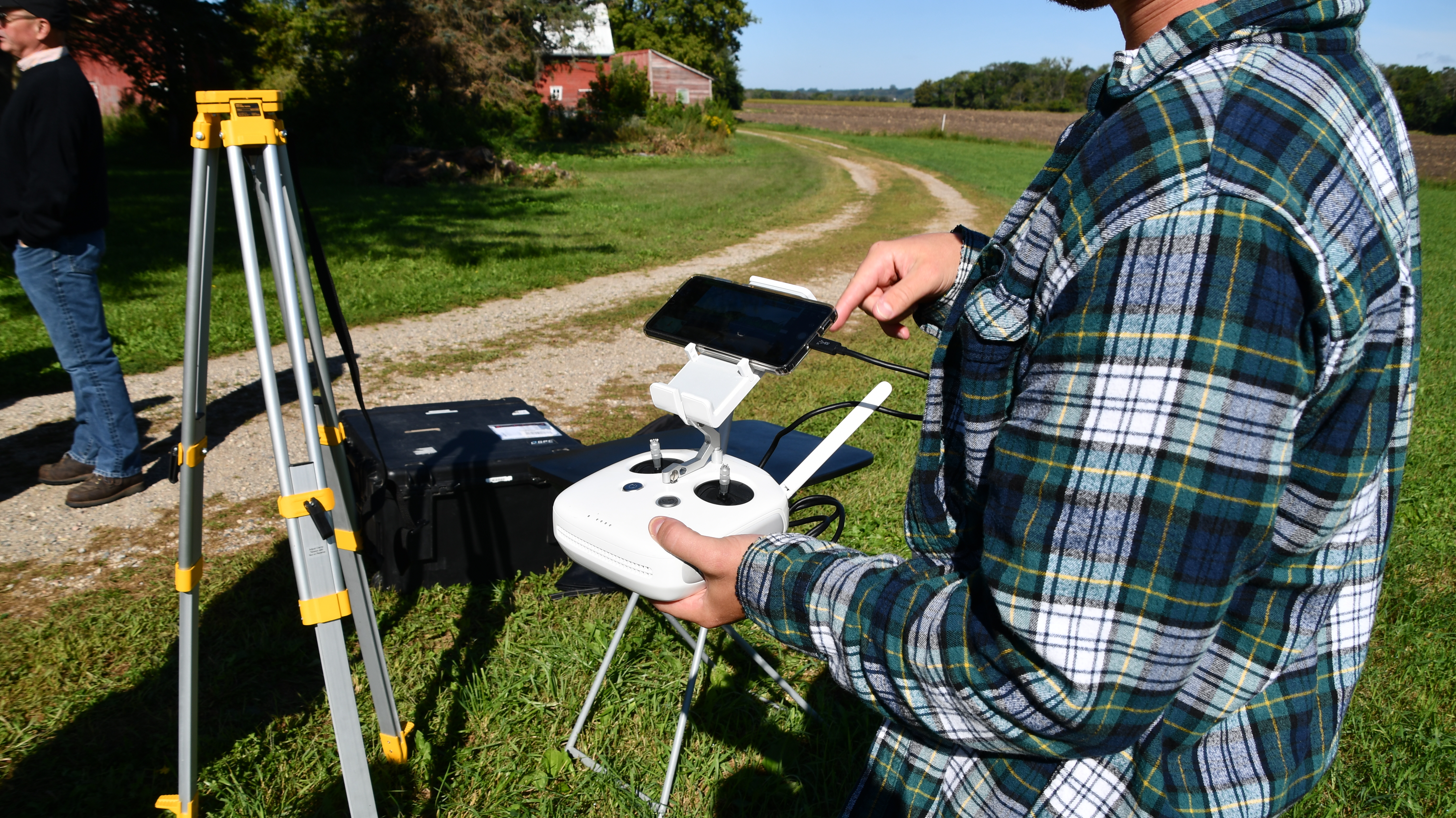
After collaborating with POLLi and the US Geological Survey through years of technology development, field testing, and beta testing, MJV is holding trainings and demonstrations to inspire others to similarly grow their monitoring capacity.
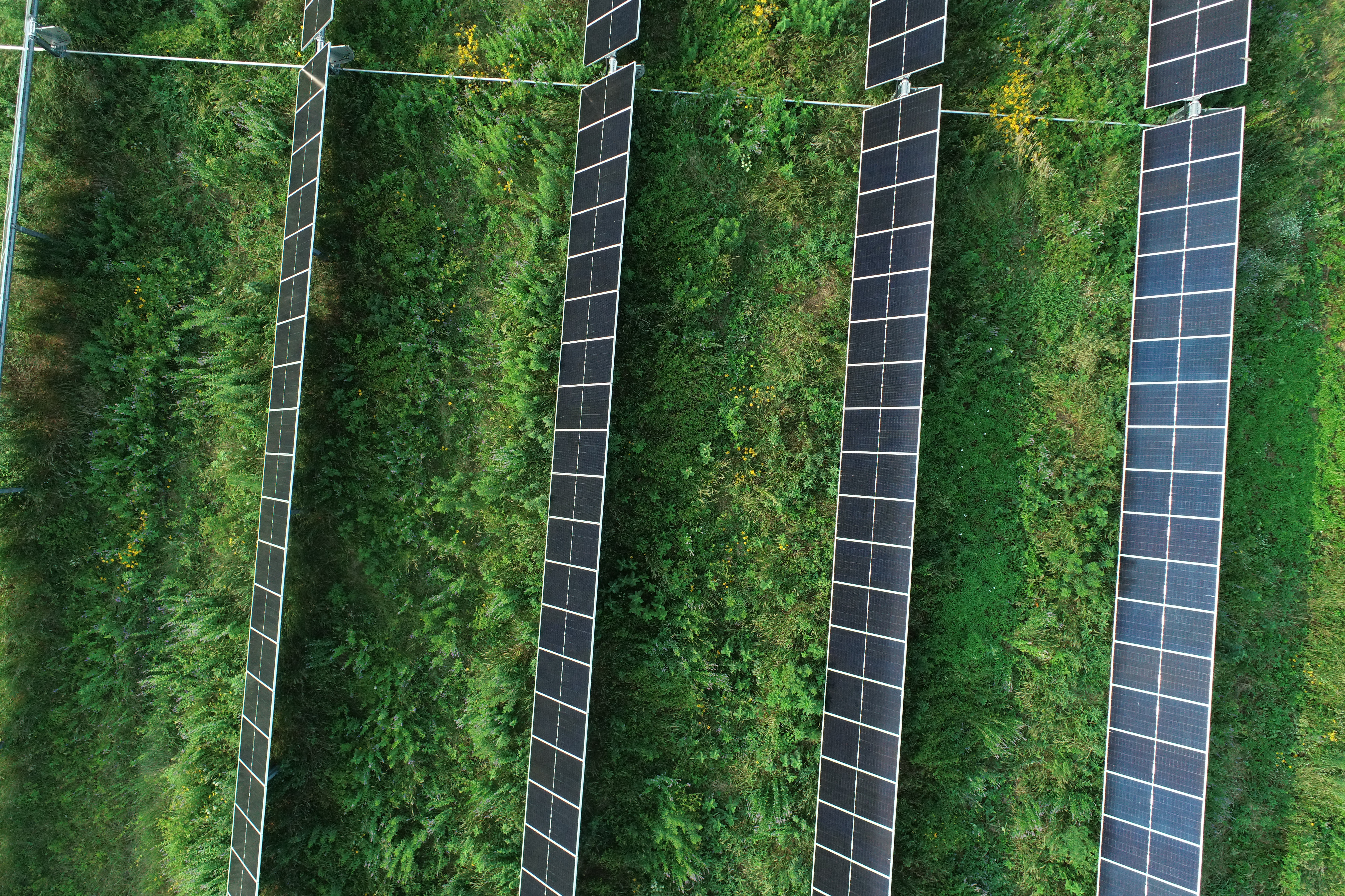
In August, MJV held a training at a solar site in Monticello for partners in the energy and transportation right-of-way sector. In early September, MJV welcomed partners to its Prairie Oaks Campus in southeast Minnesota for a demonstration of the drones they use and how they interact with POLLi’s processing platform. MJV showcased its remote sensing capabilities over an agricultural field while allowing participants to bring their own drones to test them out.
Bringing more conservation partners onto POLLi is advantageous because it offers easy ways to share and summarize data, enabling MJV to create regional summaries of milkweed densities.
The Monarch Joint Venture is currently implementing multiple projects to evaluate pollinator habitat on energy and transportation, federal, and agricultural lands across Minnesota and the eastern U.S. The project builds upon datasets gathered in 2023 and 2024 on public lands to provide a more comprehensive map of resources available to pollinators, including monarchs, across these regions. Each project includes trainings and demonstrations for those involved, such as federal biologists, conservation staff of non-governmental organizations, and corporate land managers.
“By supporting the use of remote sensing by conservation partners, we are creating opportunities for standardized data collection, broader data sharing, and ultimately stronger conservation outcomes at a national scale,” Monarch Joint Venture Science Manager Jennifer Thieme says.
Funding for these trainings was provided in part by the Minnesota Environment and Natural Resources Trust Fund as recommended by the Legislative-Citizen Commission on Minnesota Resources (LCCMR) and US Department of Agriculture.
To schedule your own training or demonstration, please visit here for options and inquiries.
Accuracy and expansion of habitat detection
Employing this technology to document common milkweed increases efficiency of quantifying milkweed. In one example shared by POLLi, field biologists walked half a mile (about four acres of surveying) along a right-of-way, counting milkweed manually. Between time in the field and entering the data, it took about three hours. Someone using drones and POLLi took less than 15 minutes in total to survey the same space and process all of the data, returning similar counts. POLLi estimated 561 stems of common milkweed, and manual counters. Manual counters reported 579.
“Remote sensing allows us to quantify and track pollinator habitat at a scale and accuracy that was impossible before, giving us a more precise picture of where management activities are working well and where they can be improved,” says Thieme.
POLLi continues to expand rapidly, including new machine learning algorithms to identify new categories and species. Another algorithm tested at scale in 2024 identifies the composition of a site’s groundcover, including flowers, grasses, trees, and other categories. This technology will benefit pollinators of all kinds through its rapid detection of specific beneficial species, invasive species and flower identification.