

Program Significance
Monarch butterflies have severely declined in recent decades, which has mobilized an array of conservation stakeholders doing their part to support the species and its habitat needs.
To understand and effectively conserve monarch populations, we need large amounts of data across all landscapes to inform habitat and population targets and conservation strategies. Monarch Joint Venture's Remote Sensing Program provides another tool for volunteers and organizations to contribute to large-scale data collection for monarch habitat.
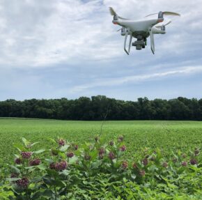
A key component to monarch reproduction is sufficient milkweed on the landscape. To properly evaluate milkweed availability across the monarch's breeding range, we need extensive physical counts of milkweed to identify where habitat needs to be improved to support their populations. Unmanned aerial systems (UASs) present a unique opportunity to efficiently collect large amounts of data on monarch habitat.
Drone Demonstrations
In 2025, demonstrations of this technology were held in August and September in Minnesota.To schedule your own demonstration or in-person consultation in Iowa, Michigan, Minnesota, or Wiscosin, click here.
Current Accomplishments and Accuracy
Simple Business Automation (SBA) and the Monarch Joint Venture (MJV) are proud to announce the release of the POLLi software platform. POLLi allows us to collect consistent photos and streamlines the analysis process for our remote sensing work. Learn more about it here!
Common milkweed served as the pilot species for the remote sensing program. The MJV and its partners collected aerial imagery of Midwest grasslands, manually annotated common milkweed in the images, and worked with machine learning developers to build, test, and refine the algorithm to detect milkweed stems at least 8" tall. A ground-truthing protocol facilitated model improvements and performance evaluation. Currently, this program can identify at least 80% of the common milkweed stems in an image (i.e., recall), each stem with a 93% accuracy (i.e., precision).
Are you looking for a new and innovative way to use your personal or professional drone? We are developing our public engagement strategy; click the green buttong above to express your interest and stay informed about the progress of the program.
The efficiency of counting milkweed and other pollinating plants is the beginning of what we intend to do. In 2024, we tested a new floral resource algorithm that can detect flower cover, blooming plants, grasses, and several other important landcover metrics. We aim to continue leveraging this innovative use of technology in service of monarch and pollinator conservation. Your financial contribution will go a long way toward ensuring we have effective tools to meet the large-scale targets necessary to ensure the monarch and its tri-national migration survive and thrive in perpetuity.
Technology Development

The Monarch Joint Venture (MJV), in partnership with the United States Geological Survey (USGS) and Simple Business Automation (SBA), is creating a precision conservation strategy that complements the critical research performed by the monarch conservation community. This new remote sensing project uses machine learning and computer vision techniques to identify and count milkweed using standard cameras mounted on drones. In brief, machine learning is a branch of artificial intelligence (AI) that uses data and algorithms to imitate the way that humans learn and gradually improve its accuracy without explicit programming. Computer vision refers to AI that derives meaningful information from digital images, videos, and other visual inputs — and takes actions or makes recommendations based on that information. For this project, images captured by drones are processed through an algorithm to recognize and count individual common milkweed stems. The geo-located data provides estimates of milkweed density across the landscapes surveyed.
To confirm the accuracy of the counts, USGS and MJV researchers are performing manual counts of clearly identified ground-truthing plots. Drone-captured images of the same plots are processed and compared to human counts to confirm the technology's accuracy.
We are also developing conservation platform capable of supporting data collected by researchers and drone operators. The tool will support multiple algorithms developed by technology partners, enabling users to track data for numerous species of plants, animals, or other environmental characteristics. The platform will support participation by all stakeholders who own and operate drones, including community scientist volunteers and professional collaborators.
Next, we aim to expand our machine learning algorithms to identify floral resources and invasive species. As we begin addressing invasive species, we are considering what features and outputs would be most useful for end-users, and would lay the groundwork for future invasive species models. We are seeking additional input from habitat managers to understand how an invasive species model could support noxious weed management strategies. If you manage or monitor large landholdings and would like to provide input on an invasive species model, please fill out this survey.


